AI
BUI
For CJ, Rebecca, Timmy, and all Bostonians without homes.
It was during the first site visit with my class that I decided my project would be more than an academic performance. Dubbed "Goose Park" and hidden under the Boston University Bridge, this tucked-away pocket of Boston was presumed to be vacant, aside from flocks of the titular fowl. It was thus unexpected for us --- instructors and students alike -- to discover that many houseless Bostonians had chosen this nearly-abandoned plot of land as their sanctuary. Although the visit was meant for inspection and documentation of the existing landscape, I decided to befriend folks who were staying on site. I learned so much from them: their names, the names they gave the geese, their reasoned aversion to homeless shelters, their eviction notice in anticipation of Head of the Charles Regattas, and most importantly, their desire for respect and autonomy. Every design decision I made for the project was thus based on the simple premise: a safe, low-to-no-cost, and adaptive living space for the homeless population in Boston. Moreover, to answer our assigned brief of the design being both residential and industrial, I opted for a micro agri- and aquacultural system to utilise existing, untapped natural resources and boost self-sustainability for the site's prospective residents.

My primary intention for this project has remained unchanged: to hold space, both literally and figuratively, for underserved communities; to confront and counter the notion of hostile architecture; and to explore the boundaries of how architecture is typically defined.
The design process started with a set of preliminary structural guidelines, based on which residents can take full autonomy in developing the site according to their needs. The two main systems to be permanently installed are:

and

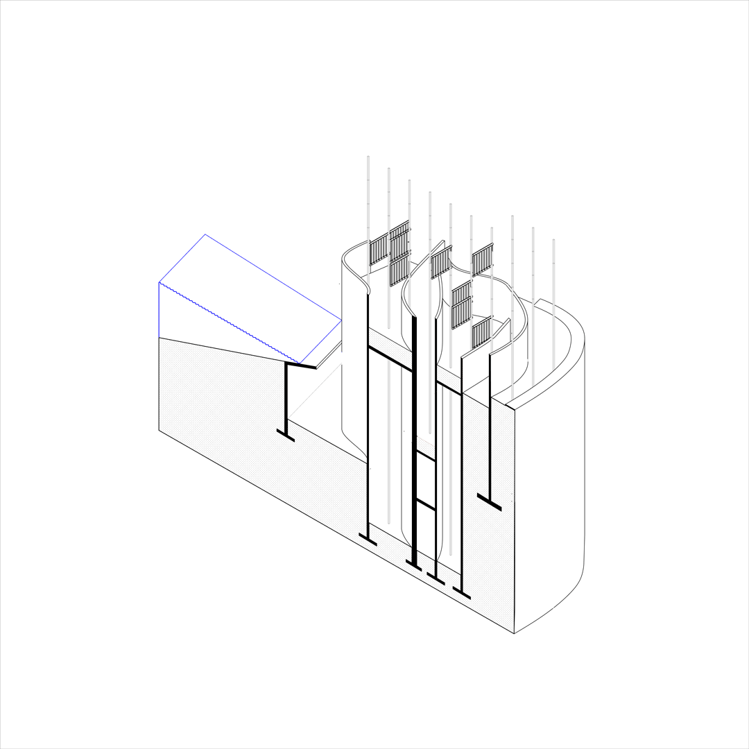
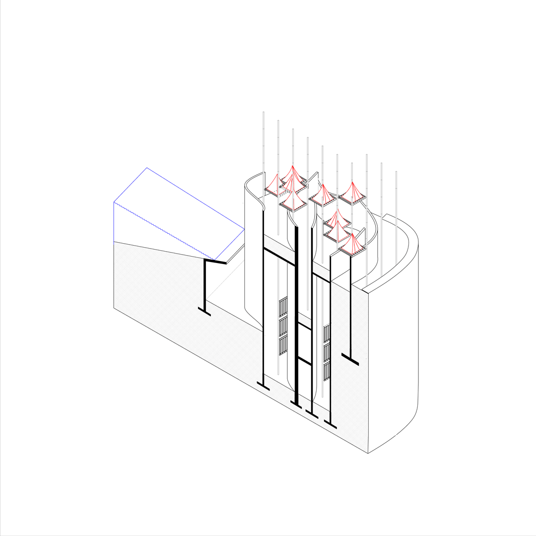
an orthogonal grid across the entire site as structural framing for tents' platforms
walls extruded from hand-drawn topographic lines as privacy screens between residents and the public.


Section drawing of populated aquaculture/agriculture program, East of train track and BU bridge.
Within these two systems and preconstructed ramps for circulation, residents can raise platforms at different elevations attaching to the grid. The platforms primarily serve as semi-permanent settle grounds for tents. The walls then serve as a static form of enclosure for these platforms, whose visibility varies on where the residents decide to place their platforms and tents on the grid.


Overground and underground plan drawings (above and to the left, respectively):
Bathrooms, washer/dryer units, and kitchens are on the lower level, along with additional residential spaces and platforms to accommodate overcrowding and/or housing during regatta seasons.

Section drawing of populated residential program, West of train track and BU bridge

Perspective drawing of populated residential program

Perspective drawing of aquacultural and agricultural program

1/16''-1' Complete Site Model
Residents populating the site's platforms during off seasons.
Residents moving underground during regatta seasons for minimal visibility.